Every source, one clear answer
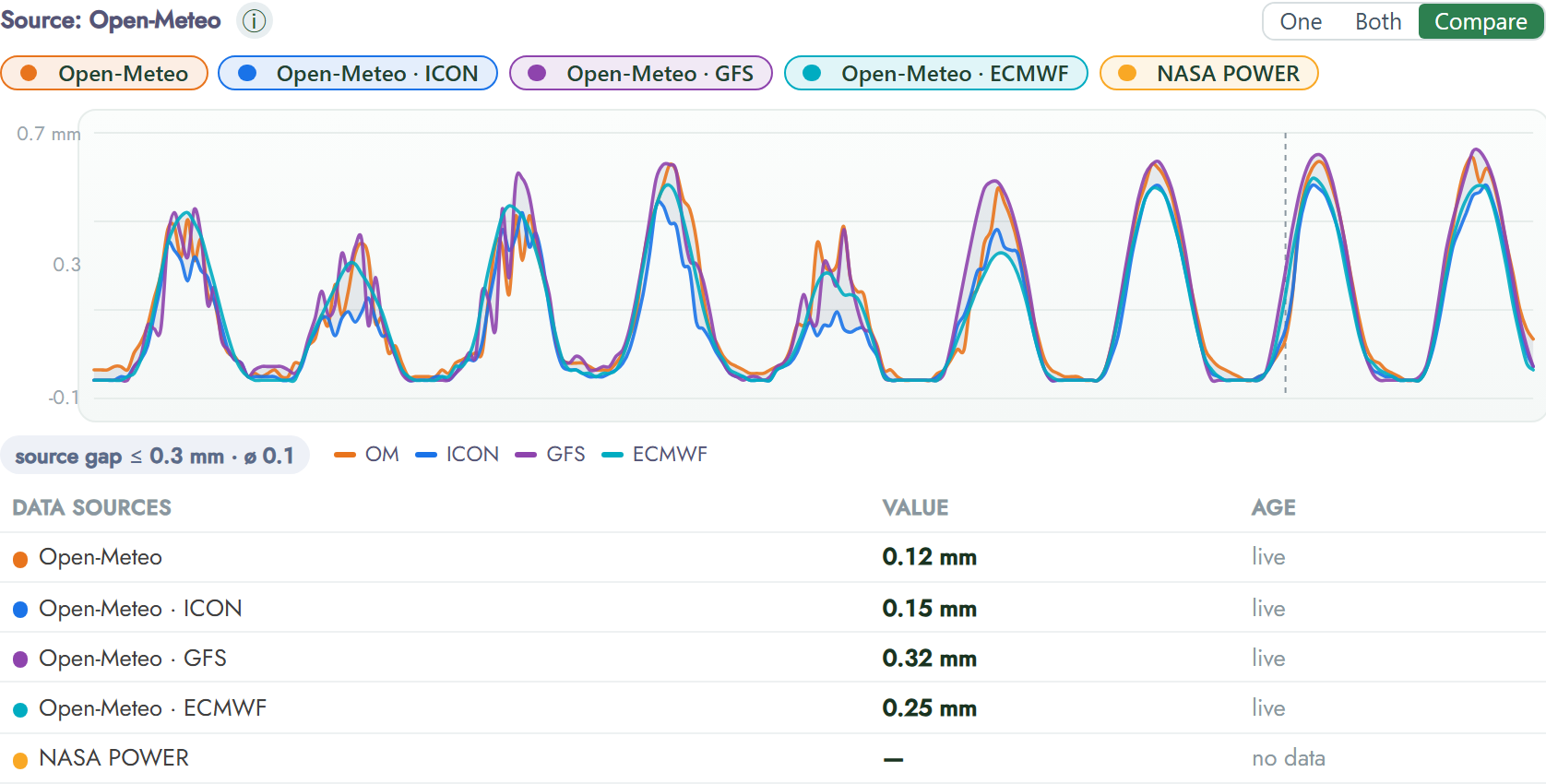
FairGrow’s compare module brings satellite data from different providers, weather models and the sensors in your own field together in a single view. Our data scientists use that combination to sharpen the models that answer your questions, so you get reliable guidance at a glance, straight to your phone.
Why one source is never enough
A satellite sees your whole field, but from far away and not every day, because clouds get in the way; a weather model looks ahead, but it is modelled rather than measured; and a sensor in the soil measures exactly, but only at its own spot. Each one is strong where the others are weak, so the compare module puts them side by side and lets their strengths add up while their blind spots cancel out.
Three layers that complement each other
Satellite imagery gives you the wide view across the whole field. Weather models tell you what is coming. Ground sensors report what is really happening in the soil, right now.
FairGrow aligns all three to the same field and the same moment, so you are not comparing yesterday’s picture with today’s forecast and last week’s reading. One field, one timeline, three points of view.
Sources that keep each other honest
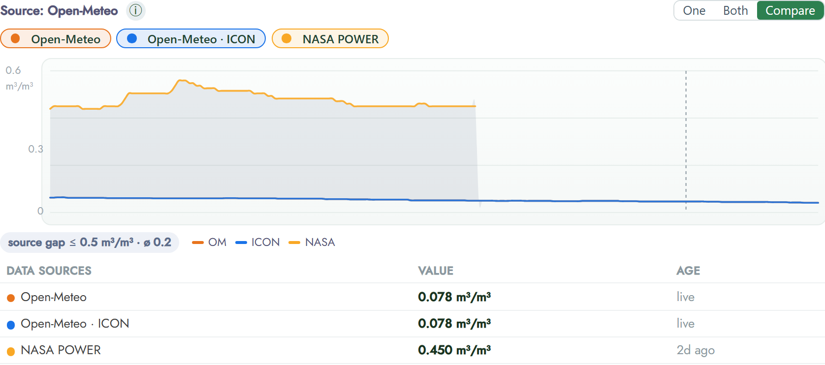
When a satellite index and a soil sensor disagree, that gap is not noise, it is information. The compare module surfaces it, so a clouded image, a drifting sensor or a passing local shower gets caught instead of quietly skewing your data.
You see the same story told three ways, and where they differ is exactly where it pays to look closer.
Models our data scientists keep sharpening
Behind the scenes, EasyData’s own data scientists and mathematicians calibrate the weather and crop models against real ground measurements, using algorithms developed in-house rather than a rented AI service.
The more your field measures, the sharper the answer becomes, because every reading feeds back into models that keep learning what your land actually does.
No dashboards to decode, just the answer
You should not have to read graphs to run your farm. Ask a plain question, “is it dry enough to irrigate?”, and get a plain answer on your phone.
The complexity stays under the hood, where it belongs. The detail is always there if you want to dig in, but you never have to.
Want a say and a look behind the scenes?
FairGrow is not a black box. Every data point and every model is open to you, so you can check the answer, question it and help shape what comes next.
See the raw data
Every sensor reading and every satellite pass is yours to open. Nothing is hidden behind a summary you cannot check.
Compare sources yourself
Lay any two sources over your own sensor data and judge for yourself which one matches what you see in the field.
Look inside the model
We show which sources feed an answer and how much weight each one carries, so you understand where a recommendation comes from.
Shape what we build
Tell us what you need: our data scientists prioritise real grower questions, so the models keep answering what actually matters to you.
Frequently asked questions
Which satellite sources does FairGrow use?
We combine open Earth-observation programmes such as Copernicus Sentinel and NASA data, so you are never dependent on a single provider.
How do sensors and satellites work together?
Satellites cover the whole field; sensors measure exact points. The compare module aligns them to the same field and moment, so each fills the other’s blind spots.
Do I need to understand the data?
No. The models translate everything into a plain answer on your phone. The detail is there when you want it, but you never need it.
Can I see the data and models behind an answer?
Yes. FairGrow is not a black box: the raw data, the sources and how the model uses them are open to you.
Who builds the models?
EasyData’s own data scientists and mathematicians, using algorithms developed in-house. Read more in our story.
Curious what your field is really telling you?
Start with Starter and see how satellite, weather and your own sensors line up, in one answer you can actually use, straight to your phone.